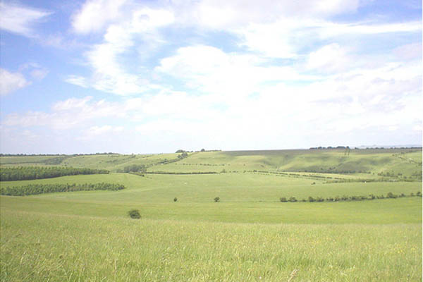
Species supported within the grassland include butterflies now uncommon in Britain such as marsh fritillary, adonis blue and brown hairstreak. All have healthy populations in the area. Most parts of the Plain are also designated as a Special Protection Area for birds, such as the stone curlew where 10% of the UK population are found. Roe deer are numerous and are often seen by day.
The Army started land purchase on Salisbury Plain in 1897 and the total area of the current estate is just over 38,000 hectares. The Training Area measures 25 miles by 10 miles (40 km by 16 km) and occupies about one ninth of the county of Wiltshire.
Defence Training Estate Salisbury Plain (DTE SP) provides walkers with the opportunity to see an archaeological landscape, which is of unparalleled importance in Northern Europe. There are some 2,300 archaeological sites including features dating back to 4000 BC, along with more recent Roman settlements. Salisbury Plain has one of the most dense concentrations of ancient long and round barrows anywhere in Britain.
Access Opportunities
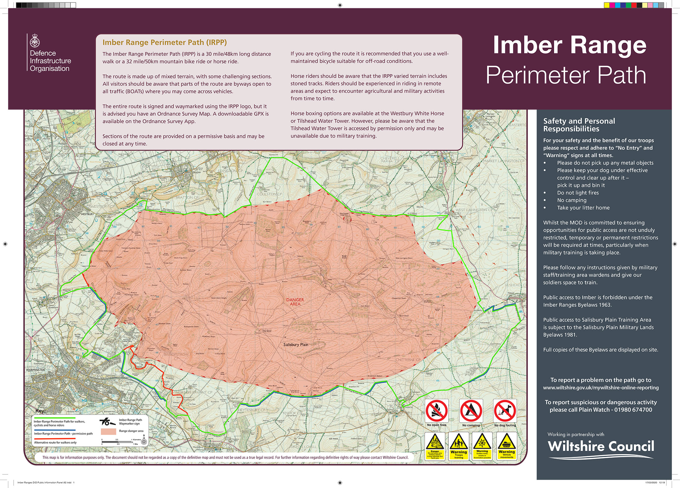
A variety of access is available on DTE SP including the Imber Range Perimeter Path, a waymarked route (see download below). The eastern third of DTE SP, the area shown as managed access on the OS Explorer map, is where the majority of access is available. The numerous rights of way remain open during military training, even when tanks are manoeuvring.
The Bulford and Larkhill Ranges are adjacent to the managed access area and are closed to the public during Live Firing. They are used extensively, normally five days per week, Tuesday and Thursday evenings and at least one weekend per month. Red flags are flown or lamps lit at night around the danger areas, at which time public access is prohibited. When the flags are down or lamps unlit at night you may enter this Danger Area. Access guidance and the bylaws relating to access to military land is available with supporting details are given in MOD literature in the Download Library.
As you can see, Salisbury Plain is a vast and sparsely populated area. Despite’s its great attractions, there will be those that seek to engage in criminal activity.
If you see anything suspicious, please call Plainwatch on 01980 674700 (a Ministry of Defence Police intelligence gathering project). The more information given the better e.g. time and place, vehicle registration, description of individuals and vehicles.
If a crime is taking place call 999 and do not challenge the offenders.
Defence Estates Newsletters
Each month, Defence Estates publishes a newsletter giving details of operational training activity, including live firing and aircraft movements. Click here to access the latest MOD monthly newsletter.
Further Information
For further information, call 01980 674763. An answer phone recording gives up to date information on areas open for public access.
OS Map References
OS Landranger (1:50,000) Sheets 183 & 184
OS Explorer Sheets (1:25,000) Sheet 130 (Salisbury and Stonehenge rev. 2009) & Sheet 143 (Warminster and Trowbridge rev. 2010).